


R-1 Precinct, Buffalo County, Nebraska
About
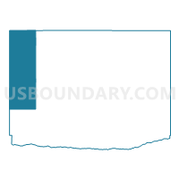
Outline

Summary
| Unique Area Identifier | 612470 |
| Name | R-1 Precinct |
| County | Buffalo County |
| State | Nebraska |
| Area (square miles) | 106.98 |
| Land Area (square miles) | 106.90 |
| Water Area (square miles) | 0.08 |
| % of Land Area | 99.93 |
| % of Water Area | 0.07 |
| Latitude of the Internal Point | 40.90429230 |
| Longtitude of the Internal Point | -99.37088440 |
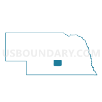
Maps

Graphs
Select a template below for downloading or customizing gragh for R-1 Precinct, Buffalo County, Nebraska


Neighbors
Neighoring Voting District (by Name) Neighboring Voting District on the Map
- Elk Creek Precinct, Custer County, NE
- Elm Creek Precinct, Buffalo County, NE
- Odessa Precinct, Buffalo County, NE
- Overton Precinct, Dawson County, NE
- R-2 Precinct, Buffalo County, NE
- R-4 Precinct, Buffalo County, NE
- Woodriver Precinct, Dawson County, NE
Top 10 Neighboring County Subdivision (by Population) Neighboring County Subdivision on the Map
- Elm Creek township, Buffalo County, NE (1,242)
- Overton precinct, Dawson County, NE (1,144)
- Odessa township, Buffalo County, NE (510)
- Grant township, Buffalo County, NE (508)
- Wood River precinct, Dawson County, NE (459)
- Armada township, Buffalo County, NE (249)
- Scott township, Buffalo County, NE (132)
- Elk Creek township, Custer County, NE (126)
- Logan township, Buffalo County, NE (114)
- Sartoria township, Buffalo County, NE (75)
Top 10 Neighboring Place (by Population) Neighboring Place on the Map
Top 10 Neighboring Unified School District (by Population) Neighboring Unified School District on the Map
- Broken Bow Public Schools, NE (4,934)
- Elm Creek Public Schools, NE (1,596)
- Overton Public Schools, NE (1,248)
- Pleasanton Public Schools, NE (1,153)
- Amherst Public Schools, NE (1,116)
- Ansley Public Schools, NE (1,048)
- Sumner-Eddyville-Miller Schools, NE (947)
- Litchfield Public Schools, NE (783)
Top 10 Neighboring State Legislative District Upper Chamber (by Population) Neighboring State Legislative District Upper Chamber on the Map
Top 10 Neighboring 111th Congressional District (by Population) Neighboring 111th Congressional District on the Map
Top 10 Neighboring Census Tract (by Population) Neighboring Census Tract on the Map
- Census Tract 9690, Buffalo County, NE (4,103)
- Census Tract 9689, Buffalo County, NE (3,555)
- Census Tract 9718, Custer County, NE (2,827)
- Census Tract 9680, Dawson County, NE (2,584)
- Census Tract 9720, Custer County, NE (1,442)
Top 10 Neighboring 5-Digit ZIP Code Tabulation Area (by Population) Neighboring 5-Digit ZIP Code Tabulation Area on the Map
- 68845, NE (19,523)
- 68836, NE (1,688)
- 68863, NE (1,151)
- 68812, NE (785)
- 68878, NE (446)
- 68855, NE (417)
- 68858, NE (266)